Enhancing Productivity in AutoCAD
Beyond Text – Using Annotative Dimensions, Hatches, and Multileaders in AutoCAD After you’ve set up annotative text styles, the real productivity gains come when you extend annotative intelligence to the rest [...]
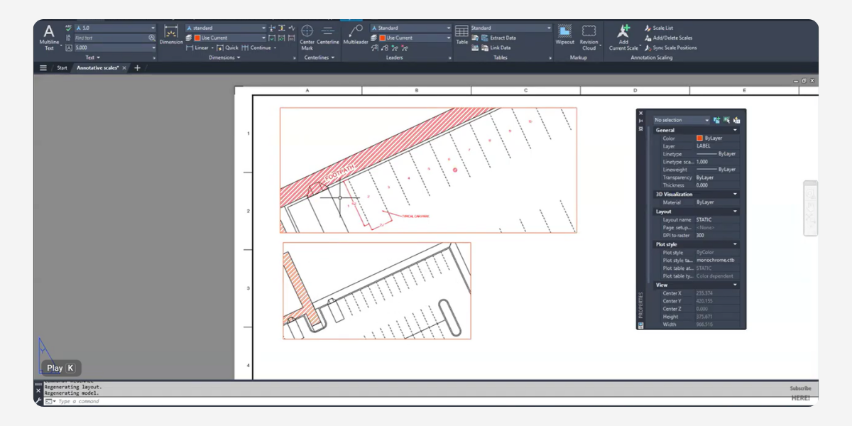
Beyond Text – Using Annotative Dimensions, Hatches, and Multileaders in AutoCAD After you’ve set up annotative text styles, the real productivity gains come when you extend annotative intelligence to the rest [...]
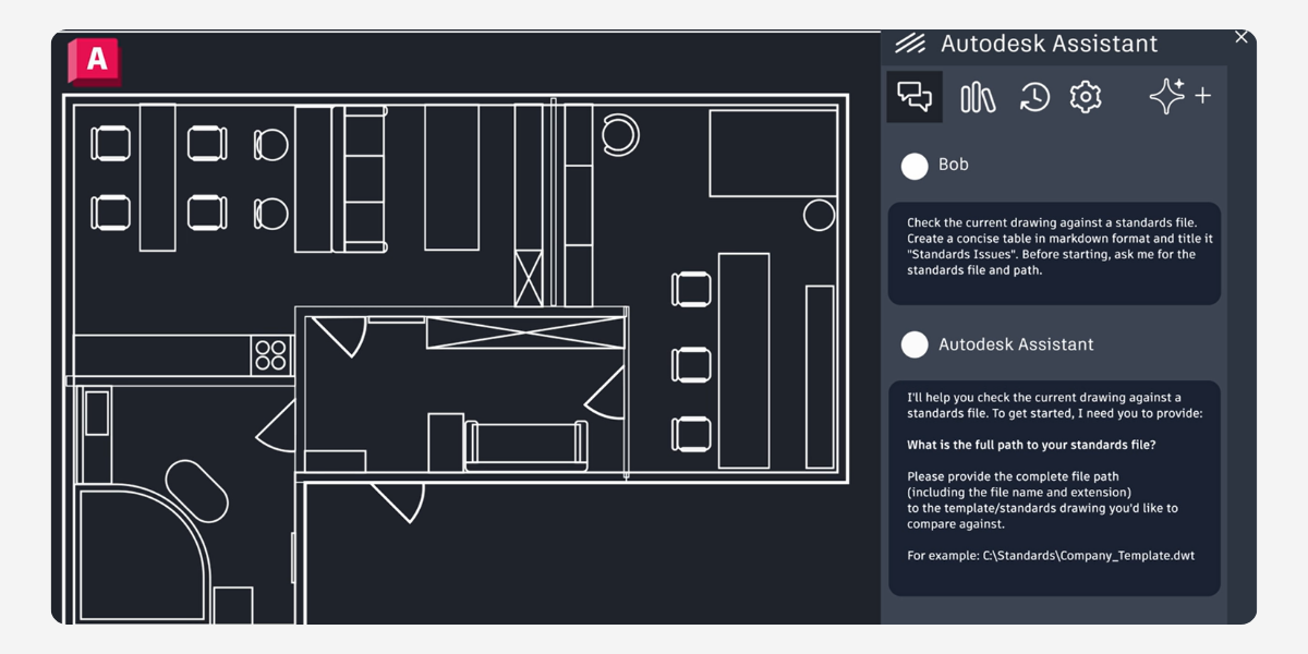
AutoCAD 2027: Key Updates & Workflows Executive Summary AutoCAD 2027 focuses on smarter automation with the new Geometry Cleanup tool for fixing drafting errors and an AI-powered Autodesk Assistant that supports [...]
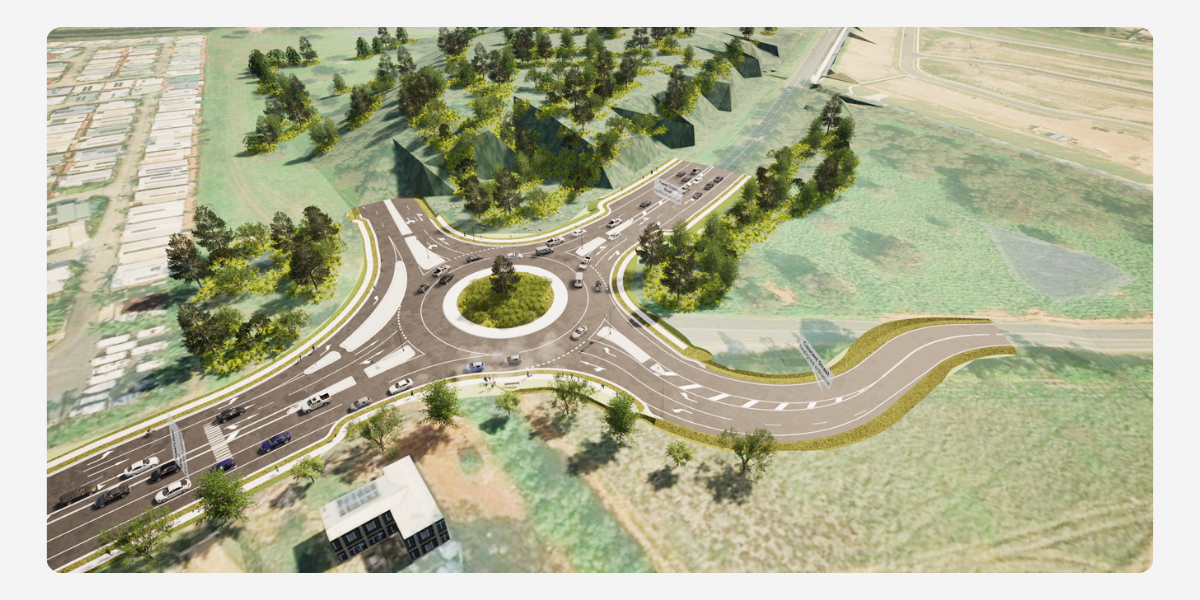
In the modern engineering landscape, seeing is believing. Today, visualisation is no longer a luxury—it’s an industry requirement.Transitioning your design from a technical model to an immersive environment doesn't just make your [...]
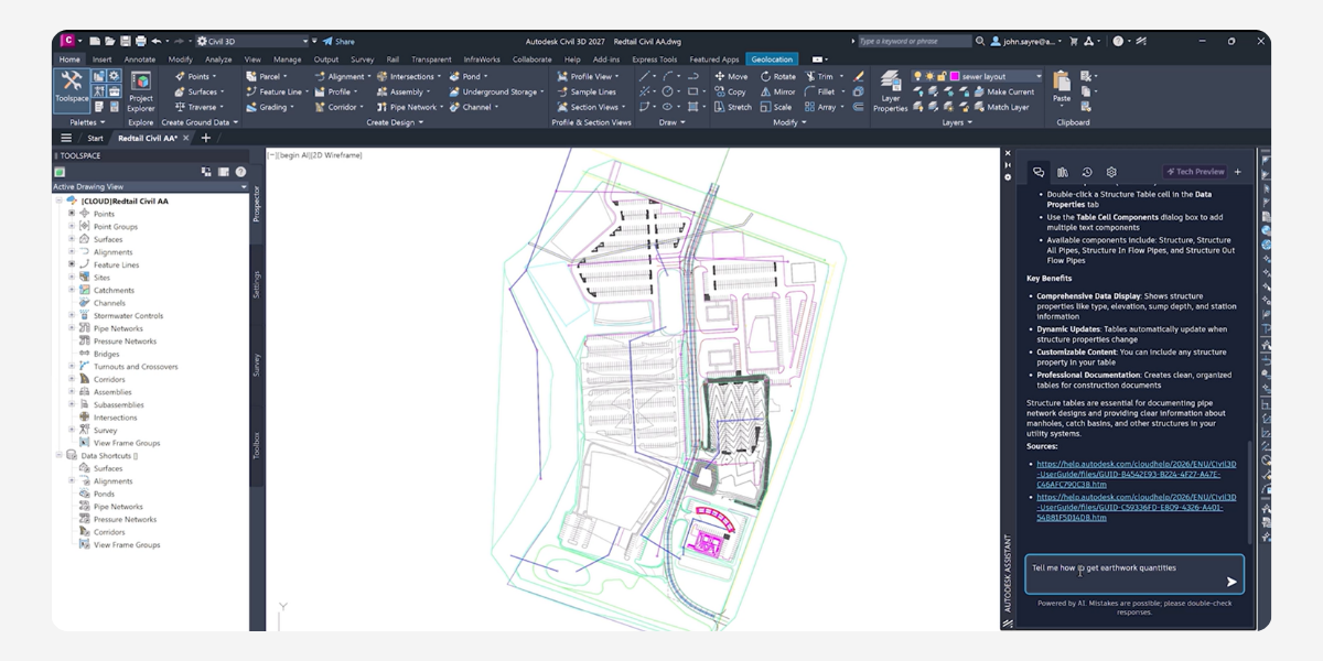
Civil 3D 2027: Key Updates & Workflows Executive Summary Civil 3D 2027 delivers a major update focused on streamlining everyday design tasks, highlighted by the new automated Daylight Feature Line and [...]
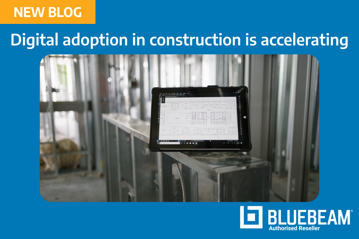
Digital Adoption in Construction is Accelerating, But Integration Remains the Biggest ChallengeDigital transformation in the construction and infrastructure industry is accelerating, with increasing investment in technology across design, surveying, and project delivery. [...]
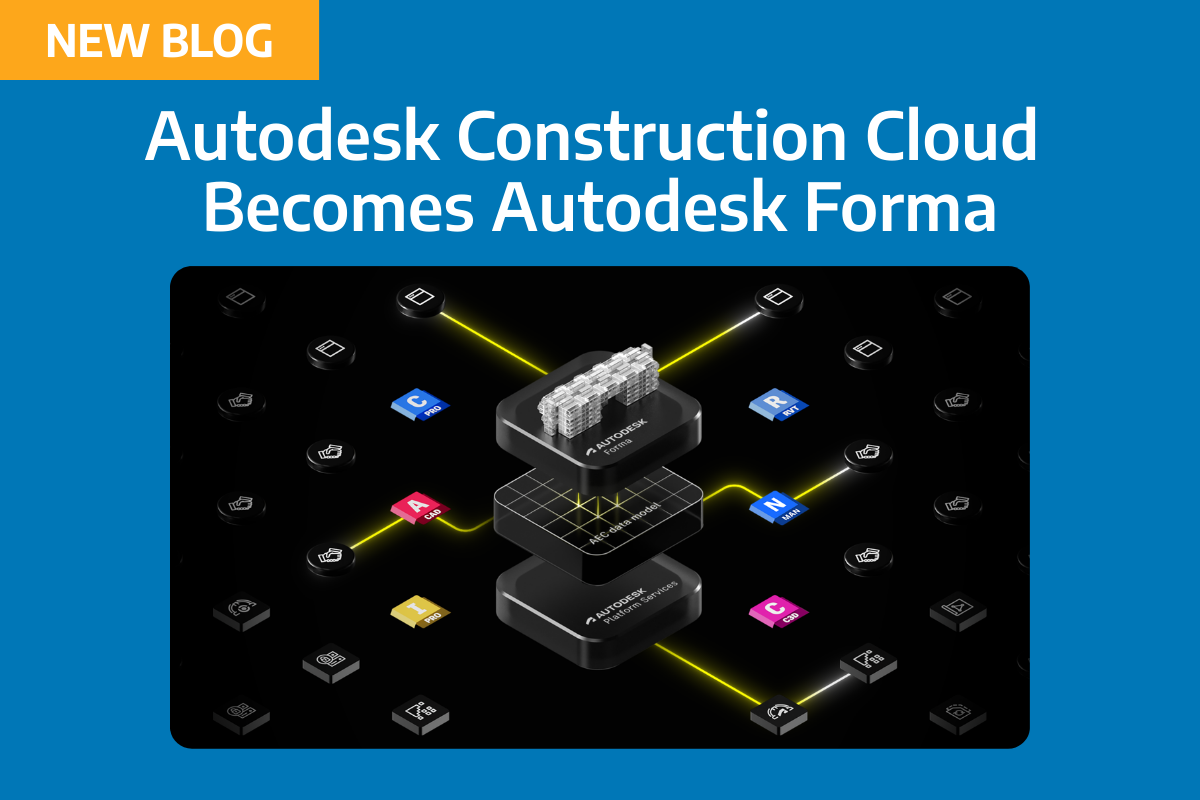
Autodesk Forma Explained: What the Autodesk Construction Cloud Change Means for Civil and Survey WorkflowsAutodesk’s integration of Autodesk Construction Cloud (ACC) into Autodesk Forma marks a significant shift in how digital project [...]

How to Get More Value from Global eTraining for Civil 3D, AutoCAD and Survey WorkflowsMany civil engineering and surveying teams already have access to Global eTraining (GeT) through their Autodesk subscriptions, but [...]

Autodesk One Team Conference 2026: What It Means for Civil Engineering, Surveying, and Infrastructure Workflows Elsa recently attended the Autodesk One Team Conference (OTC) 2026 in San Diego, joining global Autodesk partners [...]
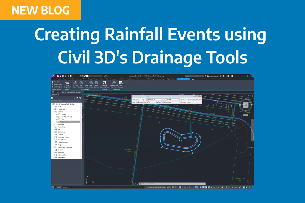
Creating rainfall events & distributions in Civil 3D In Civil 3D’s Drainage Tools, rainfall data is the final input you need before running a meaningful analysis. The 2026.2 release adds new [...]
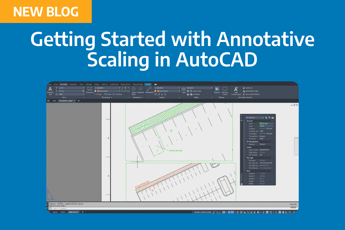
If you’ve ever duplicated text styles and layers just to get the “right” plotted height at different scales, you’re not alone. Traditional workflows often mean one layer for text for [...]