The Power of COGO Points
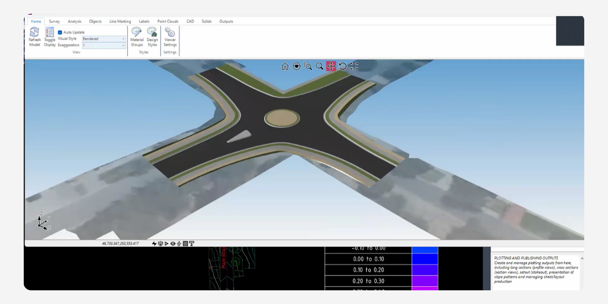
When tackling complex intersection modelling in Civil Site Design, civil professionals often face a choice of methodologies.
While traditional network strings and auto model tools are commonplace, there are distinct advantages to adopting a pure string approach, particularly for generating comprehensive and seamless long sections. However, this advanced approach presents a unique challenge: keeping intersecting design elements dynamically linked.
This is where Civil Site Design COGO points become invaluable.
The Challenge
Profile Strings are not inherently and dynamically linked to one another like road and network strings. When building custom intersection model using independent profile strings, this automatic relationship does not exist and when profile strings cross over each other in your design, they operate entirely independently and have “no knowledge of each other.”
Consequently, any adjustment to the vertical design of one would require manual recalculation and updates to the intersecting profile, increasing the risk of costly errors and rework.
The Solution
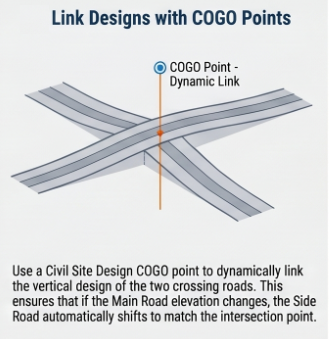 Use COGO points to overcome this disconnect, designers can establish a permanent, dynamic link between two independent profile strings by utilising a Civil Site Design COGO point. This is better than simply placing a static marker in your drawing, a COGO point can be dynamically defined by referencing other underlying Civil Site Design objects.
Here is how the dynamic relationship is established:
1. Create the COGO Point
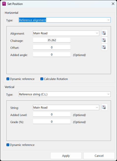
Create a COGO Point and use a Profile String to define the Horizontal and Vertical position.
Horizontal Positioning
The COGO point’s horizontal location can be defined in a number of ways. From the source string, the horizontal position can be tied to the alignment (for example, the main road) by specifying the chainage where the intersection occurs.
Vertical Elevation
This can also be set in a number of ways. Crucially for this particular application, you can instruct the software to pull the COGO point’s level directly from the primary design string at that specific location by referencing the String C.L.
2. Establish a Point Group
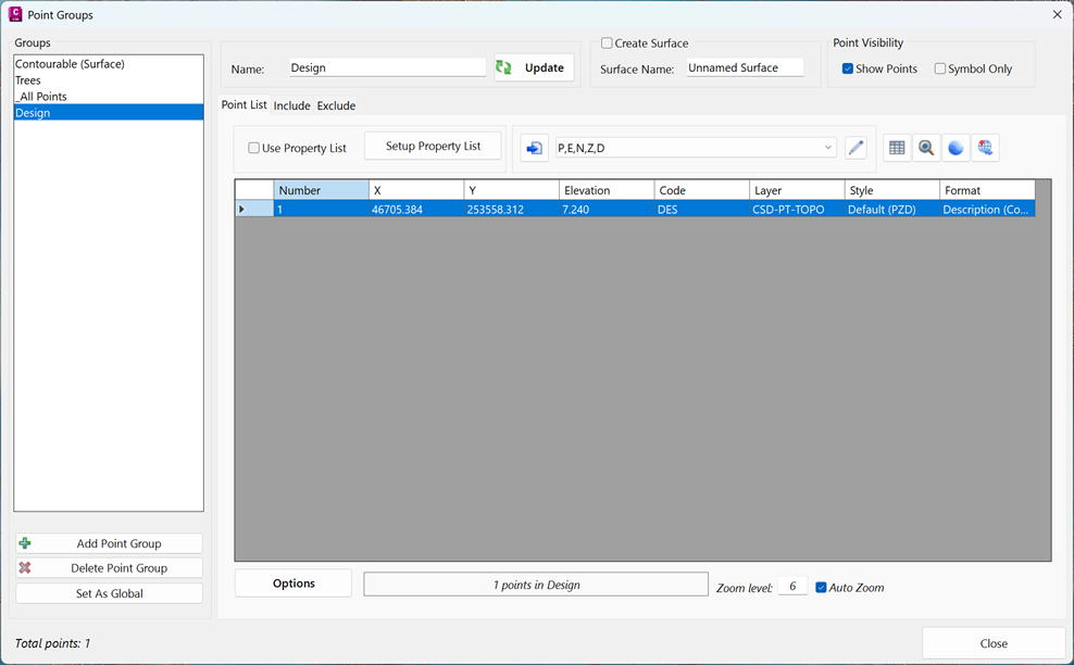
For efficient project management, it is recommended to assign a unique description code to these specific design points (such as “DES” for design) during creation. You can then set up a dedicated point group that filters and includes only points containing this specific code. This group logically isolates your critical design control points, making them much easier to reference during subsequent design steps.
3. Referencing the COGO Point with Auto Profile
Once the primary string governs the COGO point, you can apply this level to your intersecting secondary string. By navigating to the Auto Profile tools for your side road, you can choose to reference civil points and select your newly created Design point group. By limiting the chainage range to the immediate intersection area, the software automatically inserts this point into the secondary string’s vertical design, locking it to the primary road’s location and level.
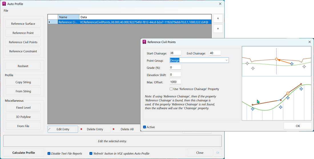
The result is a robust, dynamic connection. If the vertical design of the primary “boss” string is later altered, a simple refresh will force the COGO point to recalculate its position, which in turn automatically updates the crossing level on your secondary profile string.
Beyond Intersections | Broader Applications
While this technique is perfect for morphing levels between crossing profile strings in an intersection, the utility of dynamically linked COGO points extends far beyond road crowns. These relationships can be applied to any string type, offering significant flexibility.
For example, COGO points can be leveraged to drive a road’s design based on external property constraints. If you have critical levels that must be accommodated—such as existing driveways or finished building levels in a subdivision—you can establish multiple COGO points at these strategic locations. The software can then project fromm these COGO points directly back into the road’s vertical design, at grade or level difference if required.
Furthermore, you can limit search distances and establish complex design rules, ensuring that your vertical alignments maintain appropriate crossfalls and never violate critical tie-in grades.
Conclusion
In advanced civil intersection modelling, adopting a pure string approach provides unparalleled control over your design outputs and drafting deliverables. By mastering the use of dynamic COGO points in Civil Site Design, you can ensure that this enhanced control does not come at the cost of dynamic updates. Implementing this workflow will keep your intersecting strings intelligent, connected, and highly adaptable to change.
About The Author

We are the leading provider of civil engineering and survey software solutions and services in Australia.